What exactly is land surveying used for?
 You have all most likely seen land being surveyed a multitude of times in your life, perhaps even completely unaware of what you were watching—the surveyor, adorned with a bright orange vest, looking through a yellow camera like they are on the set of a fashion shoot. Except it’s not for Vogue’s fall edition; it’s for determining a particular piece of land’s property points.
But why? Why does land need to be surveyed and what is the survey actually used for? We will dive into that, the circumstances warranting a land survey, and relevant service offerings that may be needed. But first, let’s start at the beginning…
What exactly is land surveying?
Land surveying scientifically plots and drafts property points and the relational distance between them. In most cases, these points are used in the sale of land, to declare ownership, or to create land maps. Meticulous in nature, surveyors utilize segmented factors within math, physics and engineering to develop the boundaries around a particular plot of land. Today, innovative technologies and digitized software programs are implemented within the process for streamlined optimization and progressive adaptation.
Some of the digital equipment used includes:
- AI/Robotic ingenuity
- Light/Prisms
- GPS devices
- 3D Scanners
- Radio
- Software developed specifically for surveyors
Accurate surveying of a piece of land is imperative to the successful and continued development of the land through interchangeable real estate deals, structural implementation, and/or geographical analysis.
What exactly is land surveying used for?
Land surveying is technically multifaceted in nature and can be used for a multitude of reasons. Some of the direct and most common utilizations are:
- Initial Land Development
- Continued Land Development
- Project Implementation
- Legalities and Compliance Issues
- Boundary Establishment
- Documentation
- Real Estate
Surveying is a critical step in the procedural flow of project development and comprehensive understanding. Typically, construction companies require the land to be adequately and thoroughly surveyed before the first nail can be hammered. This also ensures legal compliance is adhered to and properly regulated.
In direct relation to land surveys, boundaries are a primary component in regards to positioning and legal separation. Boundaries can be either naturally or artificially occurring.
A natural boundary, for instance, could be divided by a stream, river or ravine. An artificial boundary, on the other hand, is developed and understood by multiple parties by way of written conveyance. Typically, boundaries are noted and kept in written documentation specifying peculiarities, nuances and other regulatory factors.
These documents are kept on file and accessible through research and proper indexing.
Particular services related to land surveying
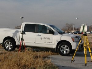
McNeil Engineering specializes in conventional surveying, boundary surveying and topographic surveying. We offer a knowledgeable team of experts to help mitigate pre-construction risk and navigate the complexities found throughout the industry.
We understand that project initiation can be a labyrinth – where one question can easily roll into three others. We offer a wide – reaching range of survey related services including the following:
- ALTA/NSPS Land Title Surveys
- Topographic/Utility Surveys
- Route and Boundary Surveys
- Construction Staking
- GIS Data Acquisition
- Cadastral and Retracement Surveys
- Subdivision Plat
- Condo Plat
HDS (High Definition Survey) Scanning Services Offered Includes:
- Transportation
- Horizontal and Vertical Construction
- Forensics/Insurance Investigation
- Historic Preservation
- Industry
- Mining
- Survey
If you have any project related surveying questions on the cusp of land acquisition or real estates sales, please feel free to reach out to us HERE today for a brief consultation and general scope of work overview.
When should your land be surveyed?
While there could be many reasons justifying the need for land to be surveyed, generally speaking they could all be broken down into 5 different categories.
- Land Acquisition – If you are in the process of purchasing a plot of land, you will absolutely want to have it surveyed first. This will give you insight into where the property lines run, and an exact acreage measurement for price comparison.
- Selling Land – If you are in the process of selling off some of the land you own, having the lot surveyed will give you the same insights—property lines and acreage insights. Both will help you sell your land at a properly valued price point.
- Land Division – Are you looking at splitting your property with someone or sectioning it off for project-based real estate projects? Get it surveyed first. Local zoning laws, compliance and regulatory factors play a major role in dividing your land into smaller parcels for sell or development.
- New construction – If you’re in the process of expansion, development or home renovation projects, it is a good idea to have your land surveyed in order to properly report structural progression to local county or city officials.
- Conflict Resolution – If there is a dispute related to property lines, a survey can provide resolution. Is there a tree causing major housing or lawn issues? This can be resolved when property lines are determined.
Conclusion
McNeil Engineering can help mitigate risk while streamlining nuanced and complex issues. If you have any other questions involving land surveying or would like to talk about your upcoming development project, please reach out to us HERE for more information.